I’ve been to all 50 States and 37 countries, many by road, so people occasionally ask how I plan my road trips. This post is about crafting the route. I recently wrote How I Plan My Roadtrips: Part I: The Research, and next, I’ll write How I Plan My Roadtrips: Part III: The Organization. Today I’m going to walk you through how I’ve been planning the route of the Iberian Peninsula trip I’m currently planning, as an example of route-planning.
I am not an affiliate of any hotel, service, business, etc. in this post. I receive no benefit from any of my recommendations.
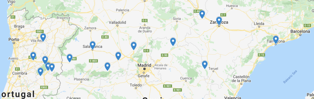
By the way: to give American readers an idea of the size of Spain, here’s a visual. Tack on some more land to the left of Spain, for Portugal. The whole peninsula is roughly the size of Texas.

I’ve said before that while I might research a TON pre-trip, I don’t stick fast to the itinerary. I veer off course, skip places, reroute, and change lodging plans on the fly. But advance planning gets me SUPER hyped for the trip, and I like knowing where I’m sleeping each night (been there done that on adventures without hotel reservations–I’m over that kind of spontaneity).
The earliest stages of planning for me mainly involve Google Maps (including Google’s My Maps Layers), the iPhone app InRoute, and, eventually, blank calendar weeks printed from TimeAndDate.com (though you could easily make your own). My travel planning journal comes later; I’ll write about that in Part III.
Most of what I talk about in this post can be planned on paper maps and/or using different apps from the apps I use. I use what I’m comfortable with–you should find the method that’s comfortable for you. I have a friend who uses Excel spreadsheets!
BRAINSTORMING THE TRIP
I start my brainstorming with one or more destinations in mind. Maybe a place I’ve always wanted to visit, like Normandy or Yellowstone; maybe somewhere we have to get to and I’m planning the route around it, like the Great Lakes trip to get to Bemidji, Minnesota, or cross-country PCSing with the military; or even a series of road trips based on something wonderfully ridiculous, like Some Guy’s Hat.


Whatever it is, I start out with at least one point in mind. For this trip, I needed to start(ish) and end(ish) in Barcelona because we are dropping my daughter Sequoia off to do a summer program for a few weeks. So I knew Barcelona would be on the map. The original plan was to get to Barcelona, spend a day or two chilling; drop her off; then just me and the husband hit the road; return for her; and then fly home.
It’s almost comical that I thought I’d stick to that plan. Or timeline. Or starting point. Or end point…Spoiler alert: It’s now a full-month-long trip with multiple legs…my poor husband.
The following is probably a little scattered, but there’s no set order when I start planning!
GOOGLE MAPS TO START
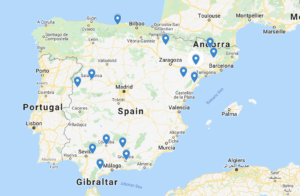
- In the beginning, I just look at the big cities and main routes so I can get a general feel for the region we’ll be in. I do this in Google Maps, where it’s easy to add and subtract cities and reroute up to ten destinations. I’m just doing this to get a visual of the land and highways.
I have wanted to visit Sevilla for decades, so I definitely wanted Sevilla on the map. We’ve been wanting to visit Portugal for years, so I added Faro/the Algarve, Lisbon, and Porto, just for the visual. I learned that my husband was very interested in seeing the Moorish influence in the south of Spain, so Granada and Córdoba went onto the map.
- I always ask the rest of my travel party what they want to see. Don’t assume you know! Seek input from everyone, no matter the age!
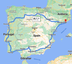
This is just a starting point for me to visualize the amount of ground potentially being covered. After years of roadtripping, I pretty quickly get a sense of “that’s totally doable” or “oh wait that’s too much.” My sense of this–especially when we were just looking at two weeks–was definitely too much if we wanted to experience some of the towns. (I could easily power-trip this in two weeks, but that’s not the kind of trip we wanted this time.)
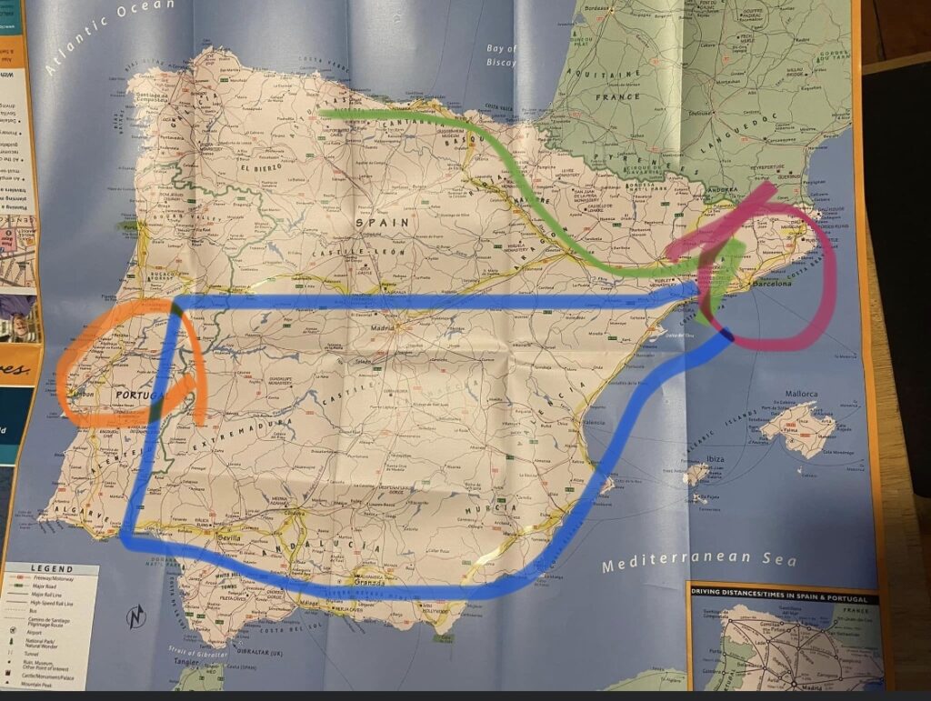
Let me just come out and spoil it for you,
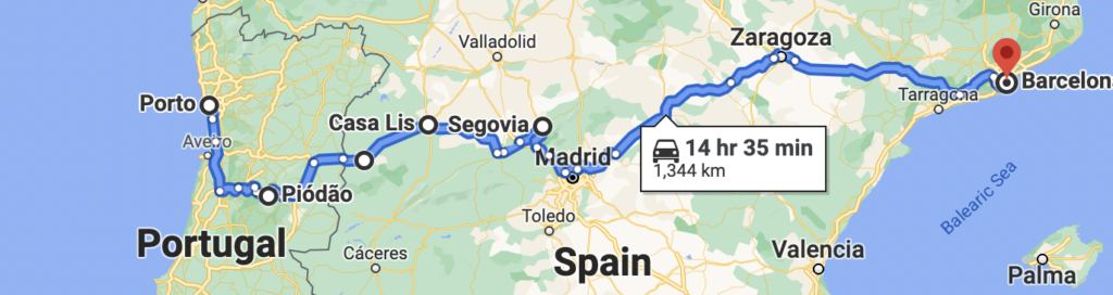
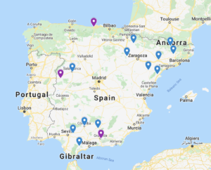
For the Spain/Portugal trip, we now have 4 legs, over the span of a full month:
for example, we are not going to be driving in the ocean.
LISBON STOPOVER (orange) – Fly into Lisbon, hang out for a few days, fly to Barcelona
GIRONA CHILLING (purple) – Pick up car in Barcelona, drive to Girona for a few days
THE BIG LOOP (blue) – Drop Sequoia off at camp, Paul and I drive to Southern Spain, do a few nights here and there, cross the border into the Algarve and up to Porto and the countryside, back into Spain for a few stops, and return to Barcelona.
THE BASQUE LEG (green) – First a night in Andorra, then up to Basque Country and the coast of Cantabria.
Anyway, now that you know what I’m hopping around between, here’s how I plan…
APPS I USE
I use inRoute on my phone when I’m researching, and then I use it on the road. For the US, you can also try the Roadtrippers app, which is fantastic for mapping, exploring, and organizing. InRoute happens to do a great job with both the US and Europe (which is where I see Roadtrippers lacking). Michelin works well for a lot of people. I’m not here to explain how to use any apps–I’m just bringing some of them to your attention. (For organization, TripIt is helpful.)


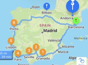
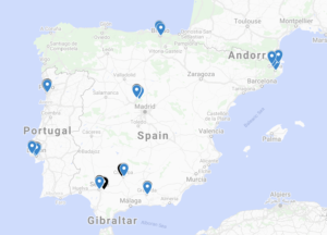
Here’s an inRoute map routing those same cities I first looked at in Google Maps for a general sense:
I didn’t think I could swing an actual visit to my beloved Basque Country this time, but next I plotted Bilbao without adding it to the route. Same with Andorra (I mean, it’s a teeny-tiny country–why not check it out?). Again: I considered this to be too much for two weeks, but I needed to know where everything was that I might want to visit.
For plotting points, I also like to use the Google Maps “Layers” function, which is 100% worth checking out if you’re not familiar. Me personally, when I saw that I couldn’t add enough layers and connect enough dots with directions (AND that I couldn’t do it all on an iPhone), I went back to using mostly inRoute because it works well enough for me and I can use it on the road. But if you’re sticking mainly with a laptop/desktop, Google Layers might be perfect for you.
I still heavily use Google Maps/Layers on my laptop; it’s not wasted time, because I print out maps for my travel planner journal. I’m going to use Google Maps for most of my examples today because I find them visually appealing.
THE ROUTE
Things are very back-and-forth at this stage, between research and mapping.
DISTANCE
**It’s really important to map the driving hours, not just miles!**
Distance and driving time are both important, but for me, hours outweigh miles. You might get twice as far on the open roads of the Dakotas as you will along a coast, up a mountain, or in a city, so just knowing the number of miles is not enough. Do not break your trip into equal miles without considering terrain, etc. I cannot stress this enough!
Questions to ask yourself:
- What’s the longest we want to drive in a day? My husband is willing to drive an 8+ hour day to get where we’re going, but I can’t easily drive that far in one day. I’d have to pull over for naps.
- How many days in a row do we want to do long hauls? I don’t like more than 2 long days in a row, and 2 is only ideal if you’re trying to get, for example, from Maryland to the 4 Corners states as quickly as possible in order to start a trip. Typically, I alternate: maybe one long day to get me somewhere, explore, then a short driving day, then the same place for a couple of days, then a short day, then a long day at the end.
- Keep in mind the stress levels. Crowded, tiny cities with a lot of bikes and pedestrians and narrow streets are more stressful than the open road. Desert roads are bumpy and slow, and you start worrying about whether you have enough water to last until someone finds you if you blow a tire, so they’re more stressful than a summer drive across the open roads of Montana. Will you be visiting a place with on-site parking, or will you be circling city blocks in search of a parking garage? Is there the potential of snow delays?
All of this really starts to matter when you’re driving for days!

SIGHTSEEING
- I mentioned in Part I that I check the Atlas Obscura map at https://www.atlasobscura.com/articles/all-places-in-the-atlas-on-one-map for cool sites to visit. I plot every interesting site on my planning map.
For this trip, that’s how I found several places I want to pop into in Spain, including some weird gardens, the pink lake of Torrevieja, bone chapels, and a random grove of redwoods(!) called Bosque de Secuoyas, which of course we are visiting with Sequoia on the last leg of the trip. In Portugal, I found Portugal dos Pequenitos, a park filled with miniature sites of interest found across Portugal–which, for this cheeseball, instantly became high-priority!
- I also mentioned in Part I that I like to see if any UNESCO World Heritage Sites https://whc.unesco.org/en/interactive-map/ are along my route. For our upcoming trip, this is how I came across some megalithic monuments and other spots I want to visit.
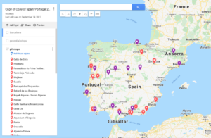
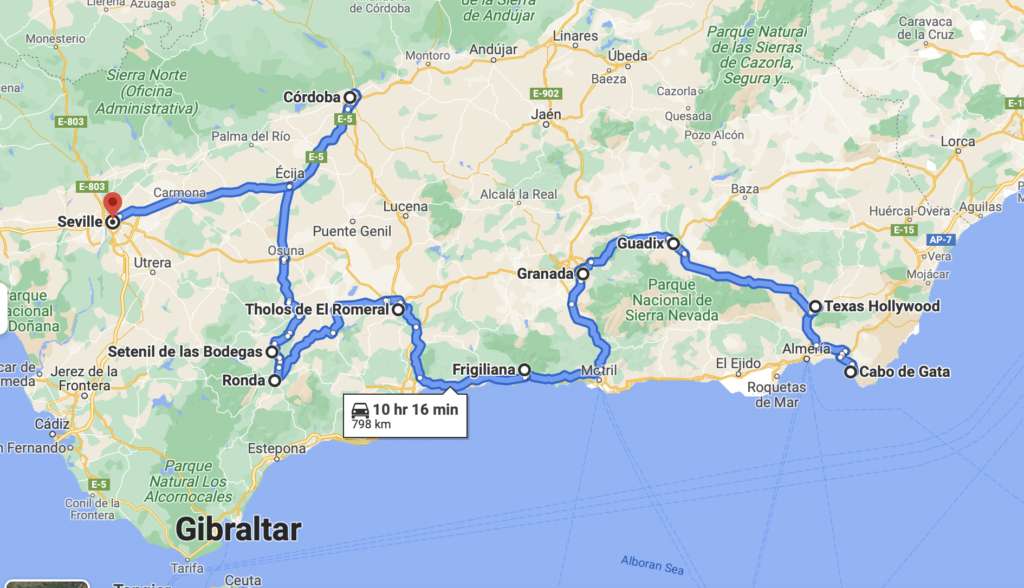
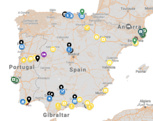
Eventually, a map starts to look like this:
Now comes the hard part: connecting the dots in a doable way.
I’ll admit that this is harder for me to explain because it’s very intuitive for me. But I’ll try.
The Moorish influence being of interest to my husband, I first focused on the south. We already had Granada, Córdoba, and Sevilla in mind.
During my research, I saw something about Cabo de Gata, a protected coastline. I read an article about charming coastal towns and considered several before settling on Frigiliana; and I read an article about unique towns, which included the cave homes of Guadix and a town built into a cliff, Sentenil de las Bodegas. From facebook posts, I saw that Ronda looked amazing. From the UNESCO map, I learned about Tholos El Romeral, one of the megalithic sites that make up a site.
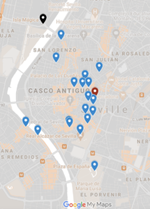
These were all plotted (along with the sites that didn’t make the cut), and then I routed just that region:
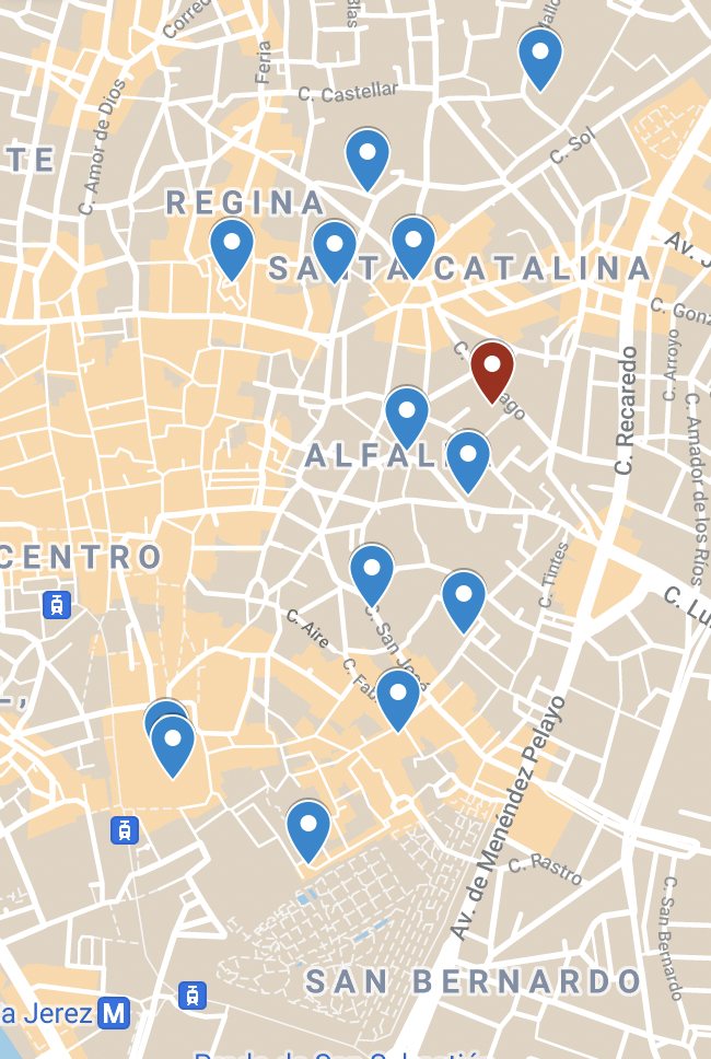
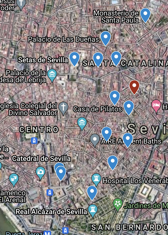
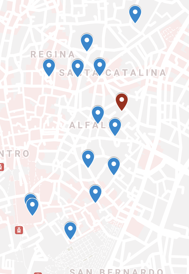
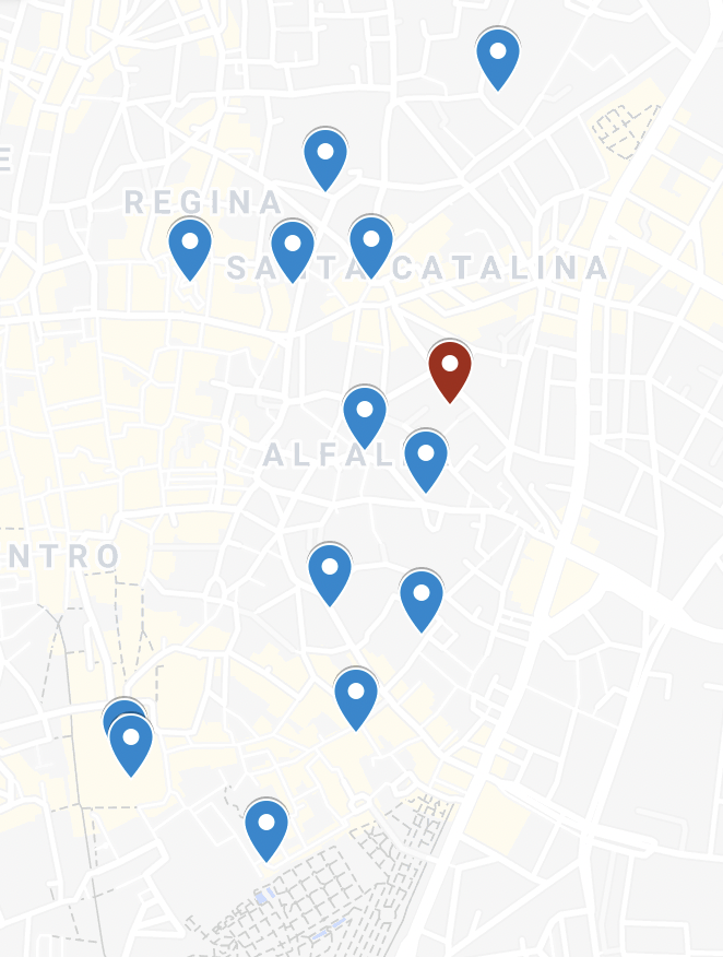
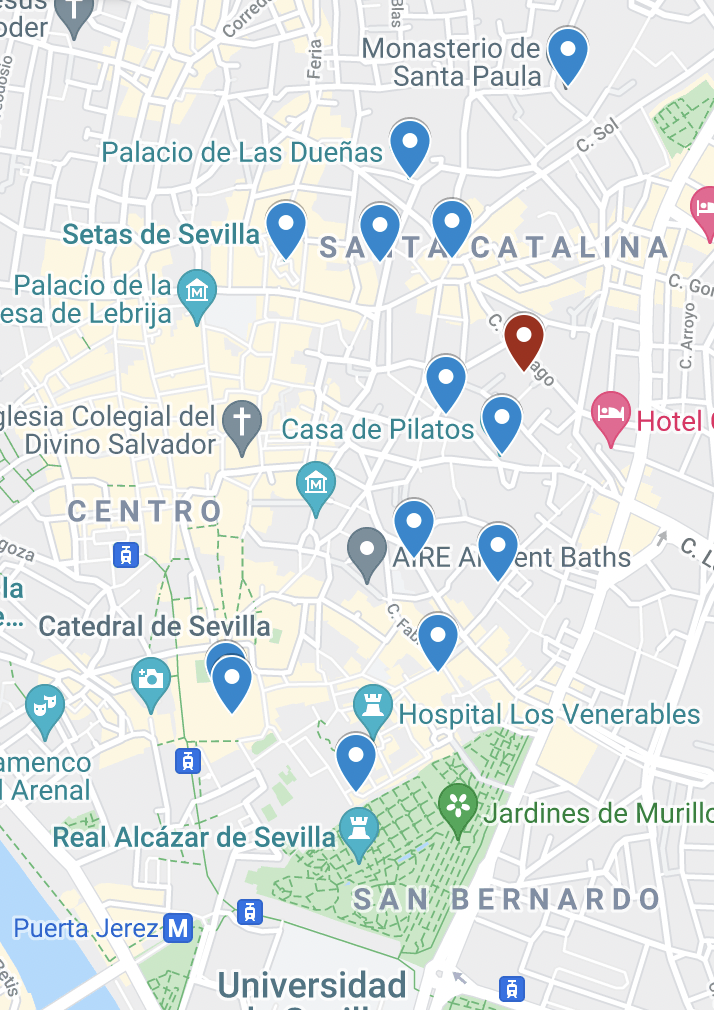
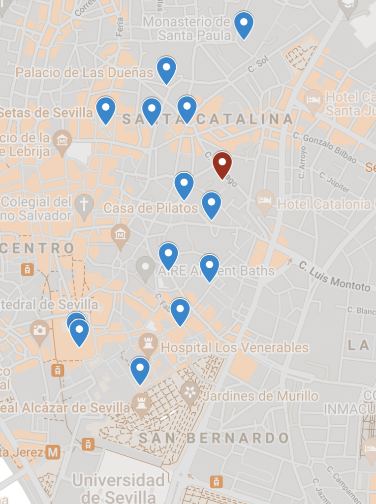
By the way: you can change the base map. Here are a handful of views of the same points around just the city of Sevilla.
Next, I looked at how to get from Barcelona > south: would I stop halfway, or would we just power through? I decided that we’re going to power through. So:
- Cabo de Gata – arrive at night, spend the next day driving around that area and then on to Granada
- Granada – arrive in the evening, then 1 full day (Alhambra tour), and leave next day for a meandering drive with several stops
- Córdoba – arrive, then 1 full day, then leave at a leisurely time the next day
- Sevilla – arrive sometime, then spend 2 full days, then leave first thing the next morning
Next, I needed to look at Portugal.
As I researched Lisbon and Porto, I was divided. I could not decide which would suit us more, but I knew we couldn’t do both. That’s what prompted me to look into a stopover. I chose Lisbon for the family stopover, and Porto for me and the husband, because for some reason, I feel like Paul and I will enjoy Porto as a couple, if that makes any sense!
So for the drive, I was looking at the Algarve, Porto, and something countryside.
During my research, I read about the 12 “Historic Villages of Portugal,” and I knew I’d have to see at least one. (I would love to drive a route from village to village, but alas, our time is limited.) I waffled between several villages, but settled on Piódão based on the route.
Back to planning the drive…
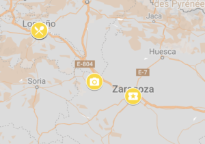
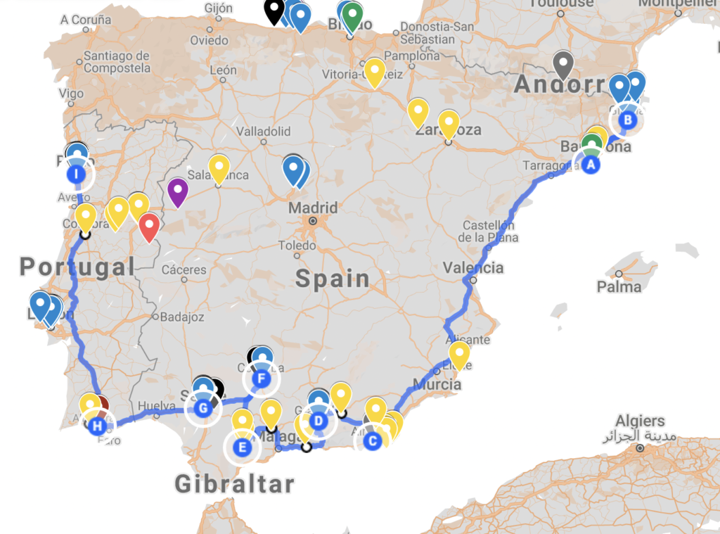
- In inRoute or Google, I start picking the most important blue pins and turning them into destinations along the route. In other words, you know all of those cool attractions, cool hotels, etc., that I found and plotted? I’m now prioritizing the ones I reeeeeally want to see, and adding them to the driving route. (In Google Maps, I’m only doing sections at a time due to the limited number of destinations for which you can get directions, whereas in inRoute, I’m mapping the whole route at once.)
Mapping the return from Porto, I was looking at about 11 hours direct between Porto and Barcelona. I knew I wanted to see something in between–I just didn’t know what. Now, remember: I had been plotting everything interesting, even if it wasn’t along my route. So I knew where I had potential stops. For example:
Now: some of these are paradores (those hotels I talked about), so they were potential overnights. Some of these are museums, others just charming towns I wanted to drive through.
There was a place I did really want to see in Salamanca (Casa Lis, an Art Deco museum) and I was interested in Segovia’s aqueduct, so I concentrated on that route. Conveniently, there was a parador right along it (Ciudad Rodrigo). I checked, and the Segovia-Barcelona drive was a little over 7 hours–doable in one day, just for the return to Barcelona. That would allow me to spend a couple days on the Porto-Segovia stretch with a few stops.
Considerations for destinations:
- How many hours/days will we need in order to see what I want to see?
- Is it a place where we want to spend a few days, or is there just one thing we want to visit and move on? If you’re wanting to get a feel for a place, you should have at least two solid days without driving, as in, get in one night, spend the next two full days, and then leave the day after. If you just want to visit one museum, maybe plan it for midday and then keep driving to a place you want to spend more time the next day. You don’t have to spend the night where you spend the day!
- Is it just a selfie spot? Plot it. Stop, see if there’s a bathroom while you’re there, pee, and bam, drive away.
- Can I time a meal stop that serves as a small sightseeing opportunity as well? This is somewhere a random cool restaurant might come into play.
- How many stops have I built into the day? How long will it take us to get to the main stop? What time will we arrive in a town? Can I do what I want to do during that section of day?
- Is anything going to be shut down at specific times? (Sundays in Germany, siesta in Spain, August in Rome, American restaurants on Monday/Tuesday, off-season closures, Covid restrictions, etc.) Note: Stay on top of Covid throughout the trip–restrictions change, staffing shortages cause closures, etc.
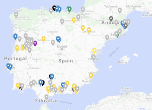
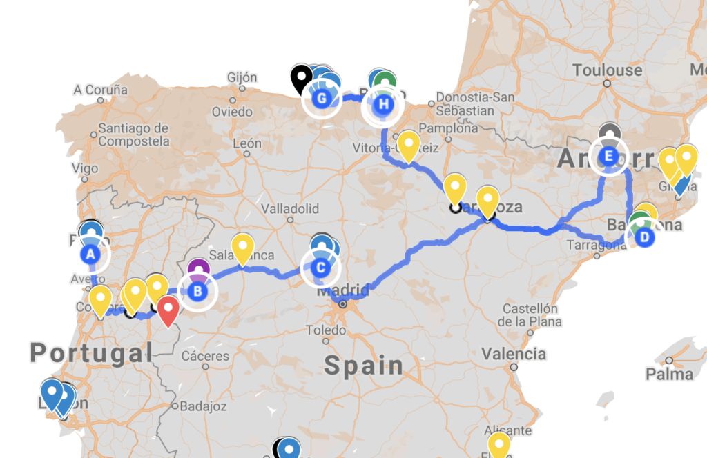
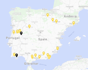
When I’m certain of a specific route, or of how much time we can/can’t spend between stops, I start dropping the rejects. I dropped the below gray points (plus some).
As you can see, I didn’t drop Andorra. I wanted to hit the country to add to my list, so I decided to prioritize it. I didn’t want to just do a quick drive-through, though, so we’re actually spending the night after picking Sequoia up from the camp.
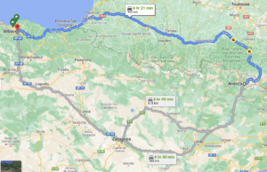
Then I had a decision to make: How to route from Andorra to Bilbao. So first I routed it directly.
Next I looked at the points of interest that I had plotted near those routes.
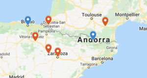
The faster top route would only go in the vicinity of only one point of interest, a witch museum. Once I routed in that museum, though, it increased the driving time by an hour. It’s a long driving day–tacking on another hour+ of road time just didn’t appeal to me.
Whereas, for an hour less of driving, I could hit three points that are of interest to me. Plus, one of them shows Moorish influence, which my daughter wouldn’t have seen much of, so I wanted to make sure she experienced it. (And as an artist, I think she’ll enjoy the botched painting restoration in Borja.)
LODGING
Note: I won’t be offering budgeting tips, but you can apply your budgeting strategies to these planning strategies.
Obviously, you can search on hotels through Booking.com, hotel apps, Google, Expedia, etc. I’m just telling you how I find my hotels (and I’ve found some good ones!).
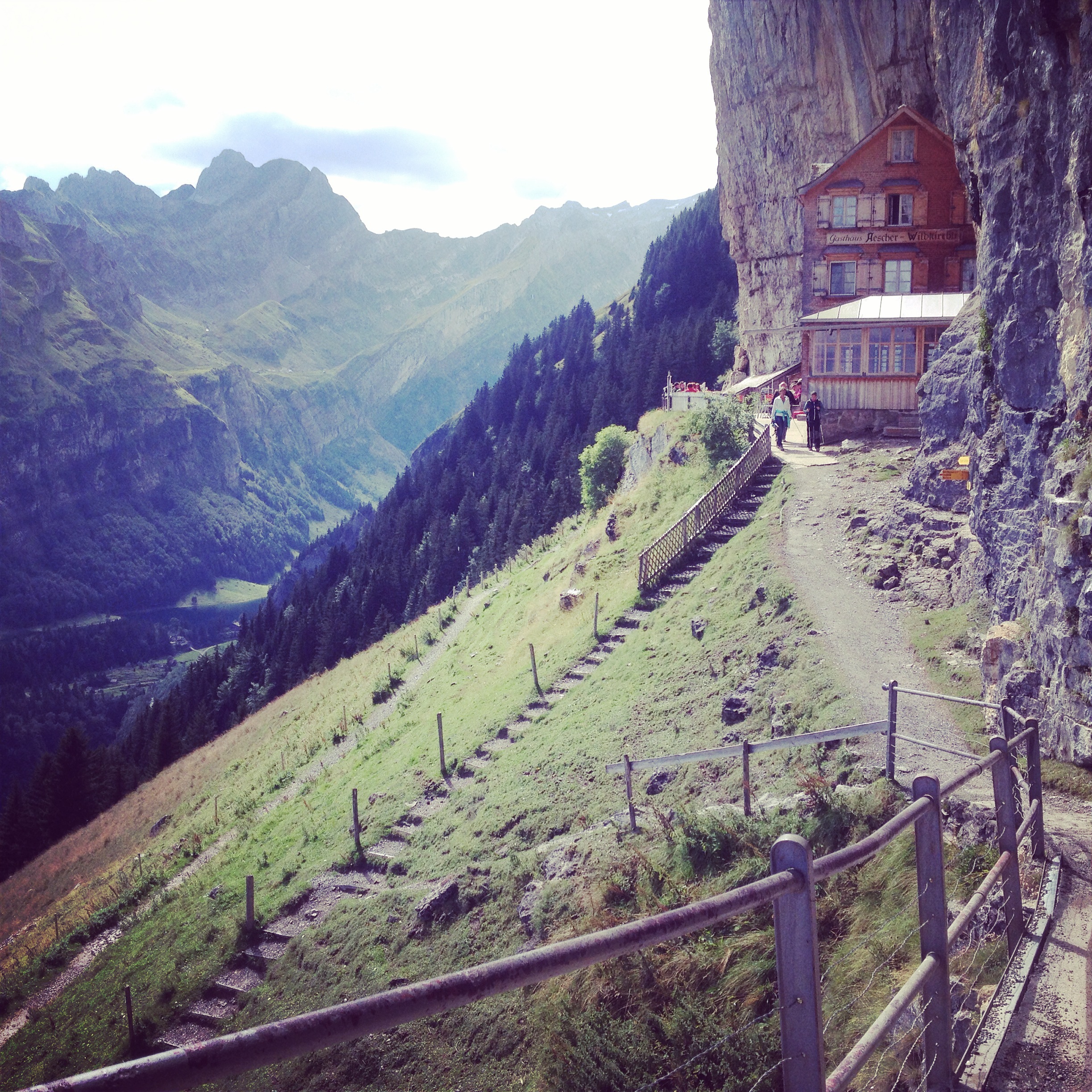
Berggasthaus Aescher, Switzerland (an absolute favorite) 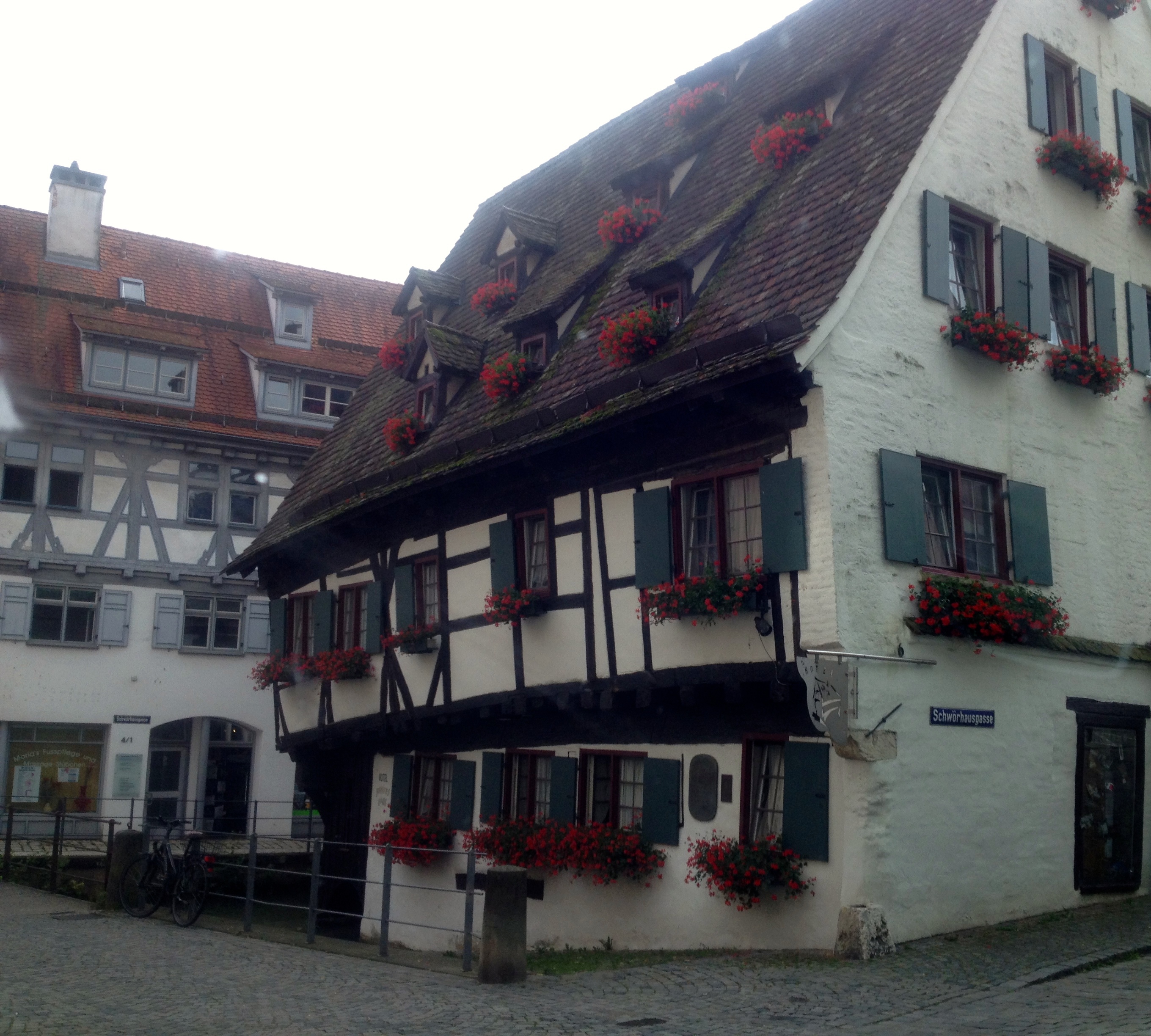
The Crooked Hotel, Ulm, Germany (yup, it’s crooked) 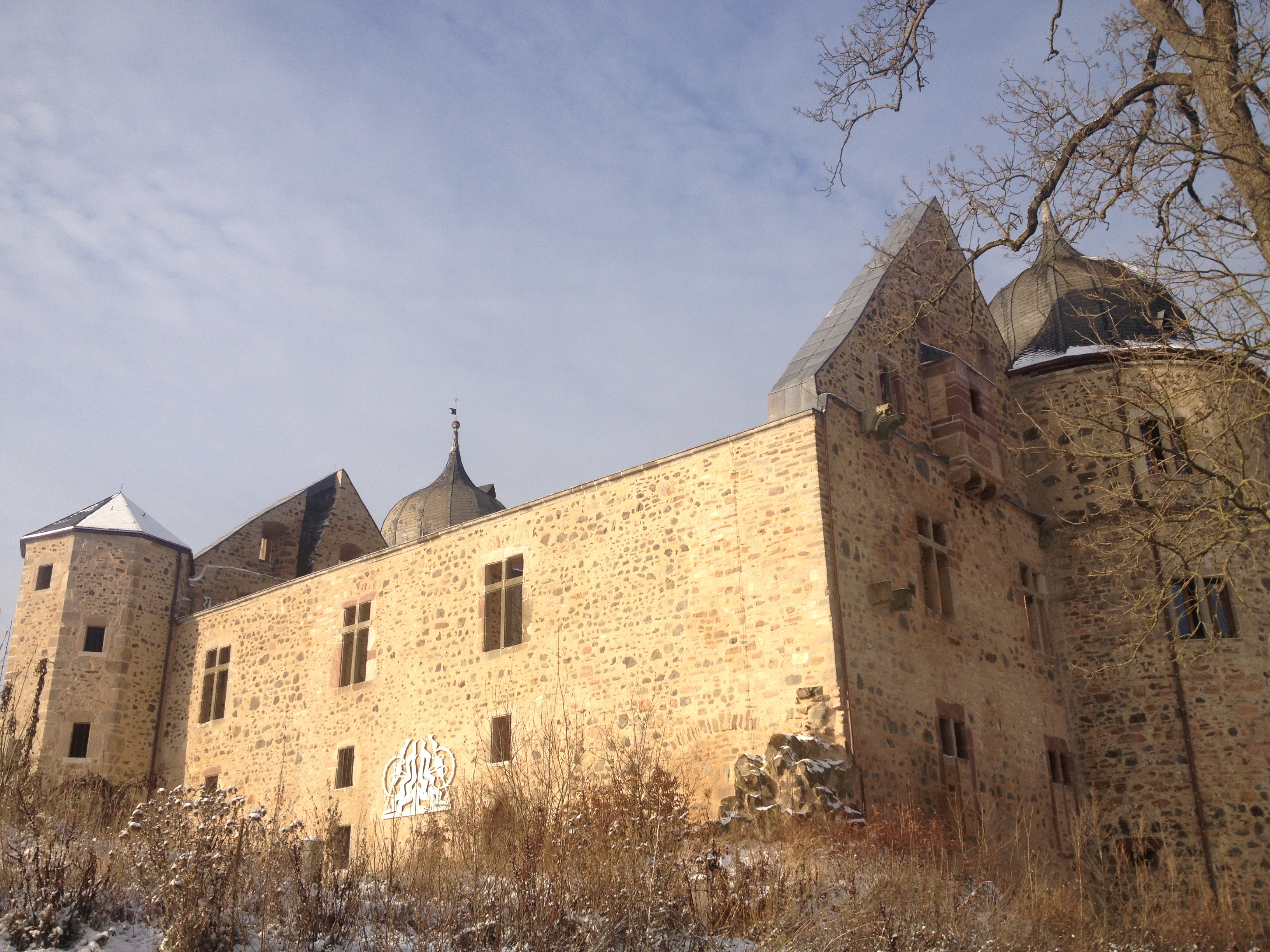
Sababurg, a castle associated with Sleeping Beauty 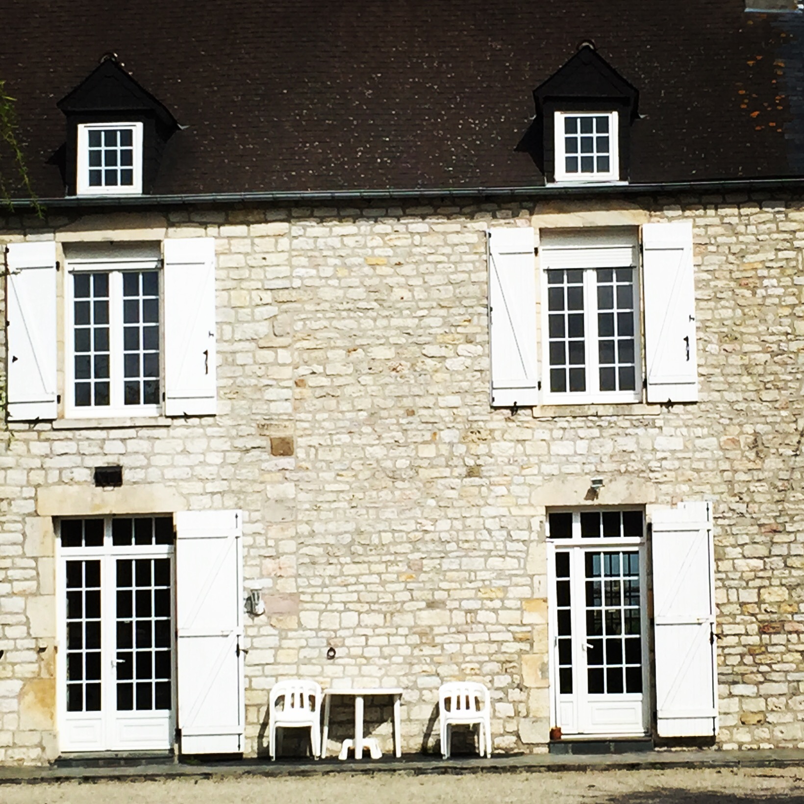
Normandy 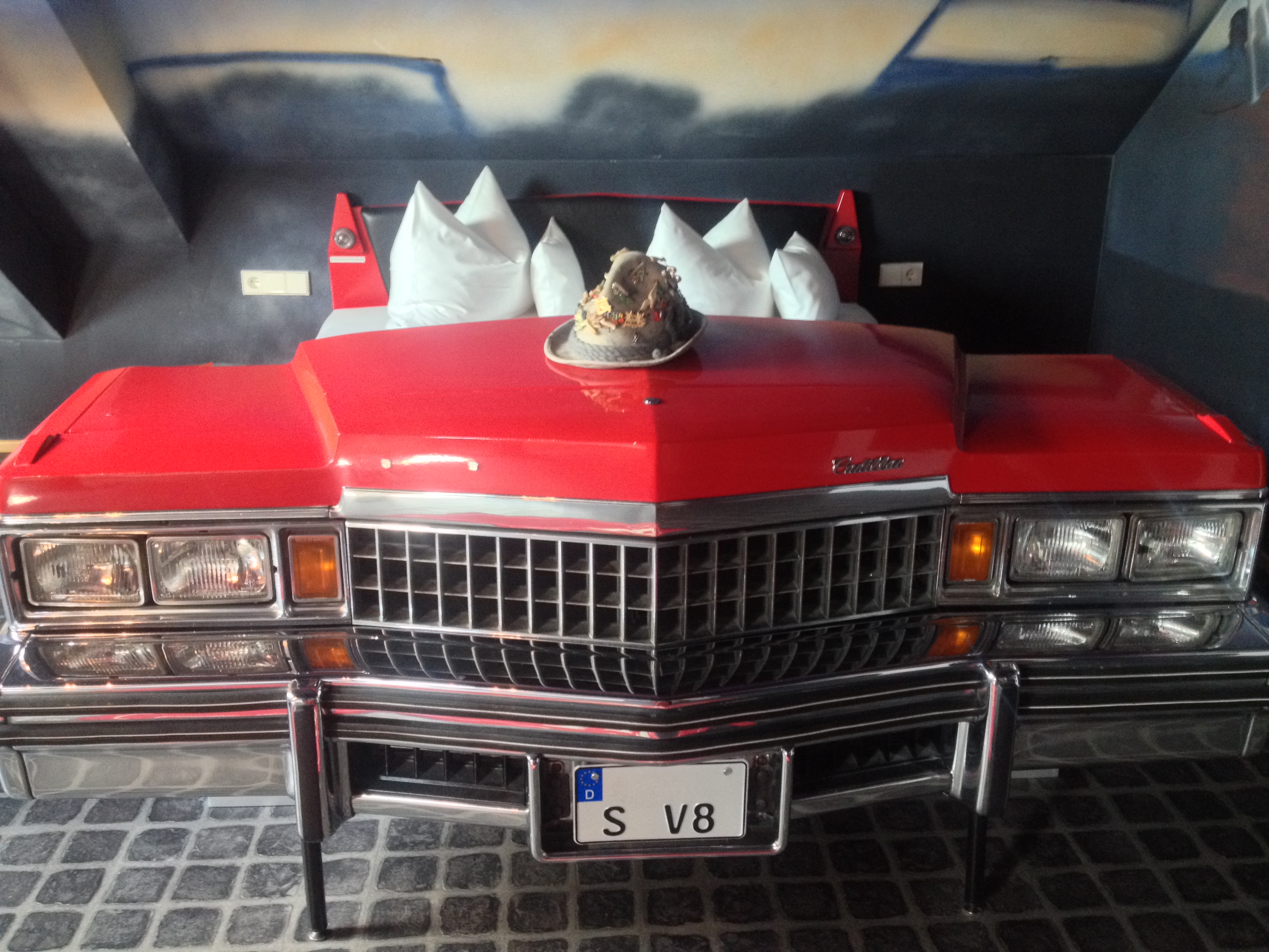
V8 Hotel, Stuttgart, Germany (that’s our bed!) 
Hotel Snowworld Landgraaf, the Netherlands (indoor skiing?!) 
Farmerhaus-Lodge , Gross Umstadt, Germany (African-themed) 
The view from the Ghent Marriott atrium 
Strasbourg, France 
Alley on Mont St. Michel, where our hotel was located 
Glamping Yurt, Ireland 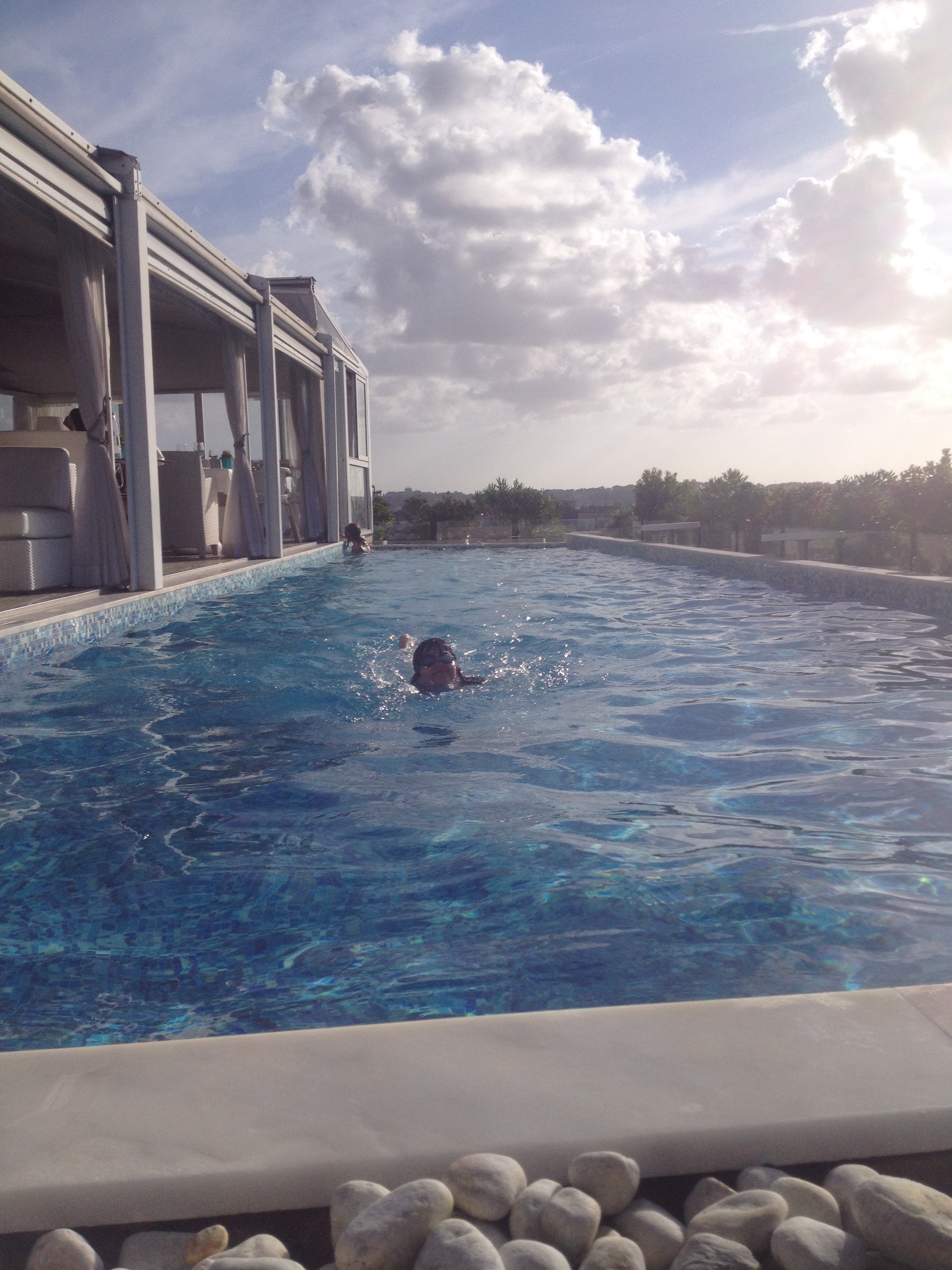
Rooftop pool, Boscolo Exedra Rome (now Anantara Palazzo Naiadi Rome Hotel, I believe) 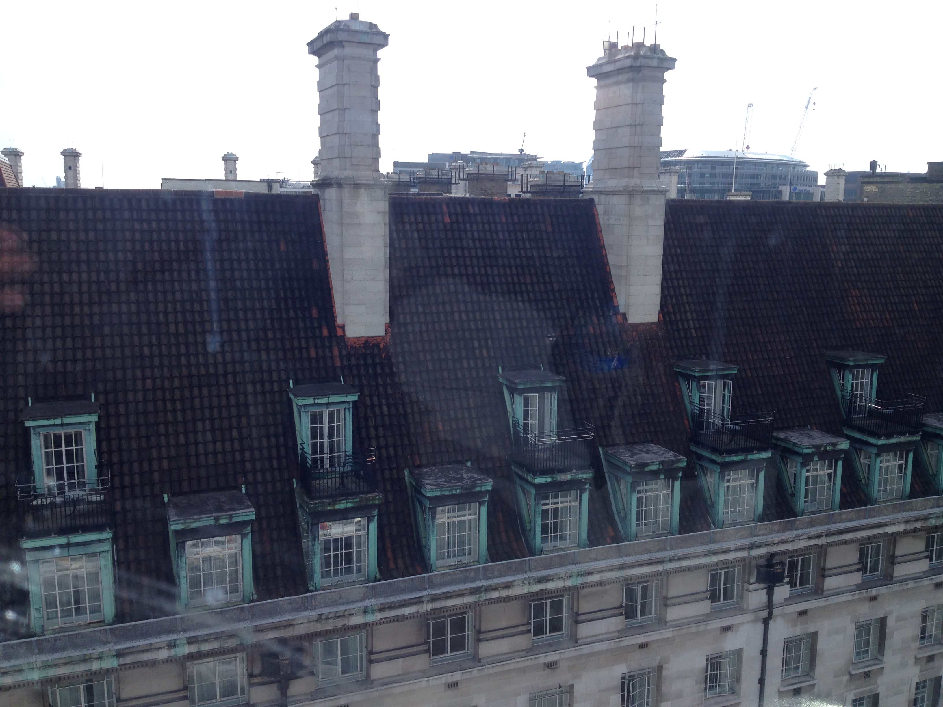
County Hall, London 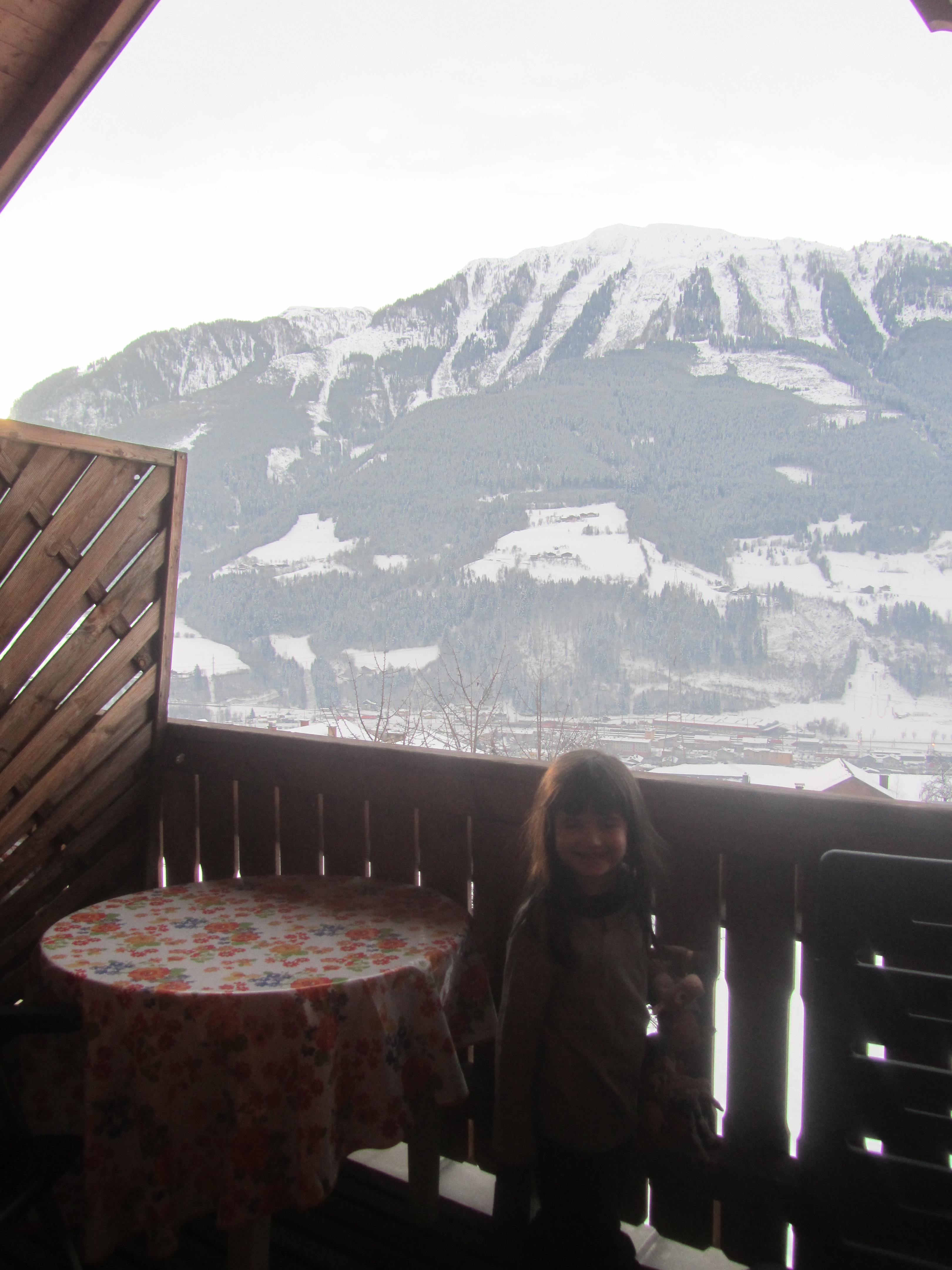
balcony view from simple Austrian hotel 
Esplenade Zagreb 
Normandy 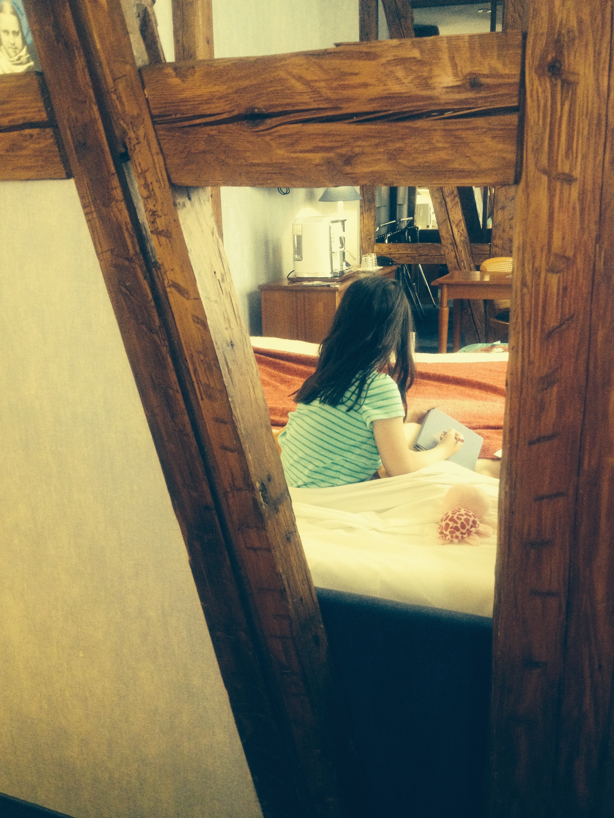
fachwerk in hotel 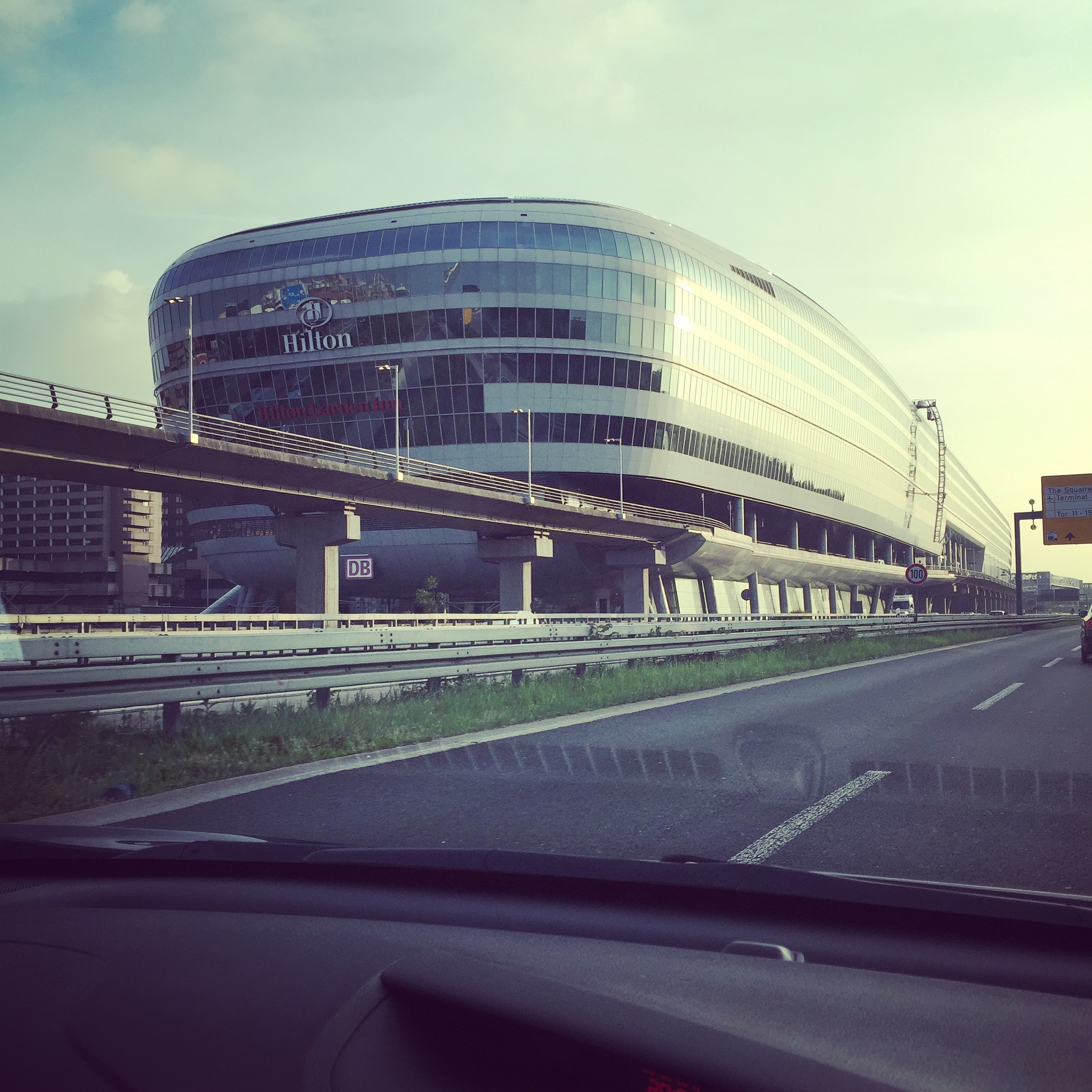
Hilton shaped like a blimp, Frankfurt Airport (we loved it when we first saw it upon moving to Germany, and then every time we passed it…so we decided that it would be where we’d stay our last night before we flew home after living in Germany) 
We will stay here this time–I took a pic last time we were in Barcelona, not even knowing it was a hotel!!
- I mentioned in Part I that I do searches on unique lodging. I plot the locations of all of the interesting hotels so that I can see what turns out to be along our route.
- A very important search for Spain: Paradores. https://www.parador.es/es A Parador is a hotel with historic or unique value, owned by the Spanish government. They’re relatively affordable–definitely worth looking into!
Early on in planning for this trip, I plotted all of the Paradores that seemed interesting to me as potential overnights, or those in the areas I knew I’d be visiting.
In the end, I chose two for this road trip: one on the grounds of Alhambra(!!), and a castle within a walled city (we’re staying in a tower room!).
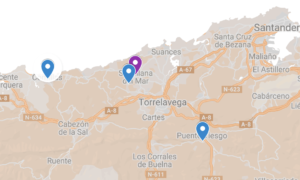
BREAKING NEWS!! – While writing this post, I revisited my lodging up in Cantabria and I changed our lodging from a hotel in San Vicente de la Barquera to a parador in Santillana del Mar. My itineraries are never set in stone! (In the earliest stages, I try to make refundable reservations for just this reason.)
GOOGLE MAPS: ZOOM IN!
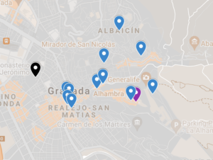
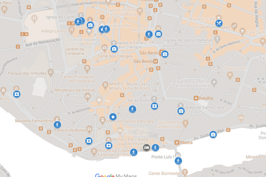
While planning, I plot sites in specific cities/towns. This will help me narrow down lodging as well as tell me if I can do the city in a day or if I’ll need a few days.
- Find your city, search on hotels, zoom in, and start clicking.
I want to find the most suitable hotel closest to the part of the city I will be walking around in the most. After all, I wouldn’t want to type in “New York City” and choose a hotel in Queens when I want to walk around every day in Lower Manhattan.
Zoomed in, you can see in blue where the most sites are concentrated, and then, in the center in dark gray, where I chose lodging.
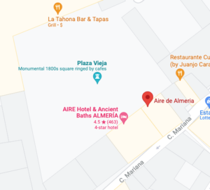
Zooming in is also how I chose our hotel in the Cabo de Gata region: I saw “Ancient Baths” and “Plaza Vieja” and I was sold!
If there’s a compelling reason, though, I might not choose the closest hotel. For example, I wanted us to stay at the parador at Alhambra. So while I’d normally be looking in the center of town, we’ll be where the purple marker is.
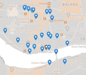
Same with Porto: I’d like to be on the river, with river views, so we’re staying where the dark gray point is, not downtown.
One of the hotels I needed to just find and go with was for Cantabria, as the things I want to see/do aren’t all in one town. What I found is central enough.
I zoom in at airports if I’m just looking to stay overnight before my flight out. That’s all about eliminating stress by already being where we need to be on departure day.
In Part I, I mentioned joining facebook groups. That’s where I heard about Casa Cundaro. I looked it up and read, “Casa Cundaro is located in Girona’s Jewish Quarter, less than 350 feet from the city’s cathedral. Set in a traditional Jewish house, it features rooms and apartments with balconies.” I’m sold!
I mentioned in Part I that I like to know what Marriott’s unique lines have to offer, so I visited the app and checked out the Marriott properties along our route. So, now I’m looking forward to staying at Ercillo de Bilbao from the Autograph Collection, the Design Series hotel Hospes Las Casas del Rey de Baeza in Sevilla, and Pine Cliffs Algarve from the Luxury Collection.
And then there are hotels I just come across, who knows how. When I was researching hotels in Barcelona, I came across one that’s actually the building that has googly-eyes all over it. I audibly squealed–I’d had no idea there was a hotel in there!
So here’s what the hotels look like and how they were identified:
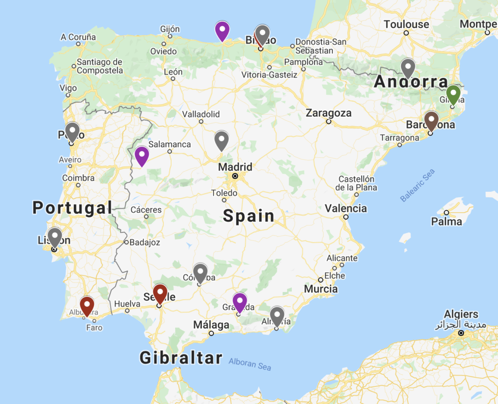
Dark red: Marriott app (there are 3, incl. one up in Bilbao behind the gray point)
Green: Facebook recommendation (1)
Gray: Zooming in on Google Maps (a bunch)
Brown: I don’t remember! (1)
Now, for all you map geeks, there’s something about Layers that I haven’t told you about yet: not only can you choose different colors for your pins, but you can choose icons if you wish. You can go through and indicate what’s a restaurant, a hotel, a photo op, etc.
This comes in handy if you’re trying to visualize how much of a city involves walking, quick photo ops, museums and tours, etc. It also comes in handy if you’re visualizing a driving day, like the Andorra > Bilbao route. If I look and it’s a long string of attractions, it might be too much to do in a day, meaning that I’d have to narrow it down to my favorites.
Calendar
I might be using my blank calendar page(s) at this point.
Using the calendar is mainly how I visualize the overnights. As you’re driving from place to place, you can get mixed up, like, okay, if on Monday I’ll be in Philly and on Tuesday I’ll be in Buffalo, am I spending Monday night in Philly, Buffalo, or an in-between city? I write my lodging across the bottom of the days.
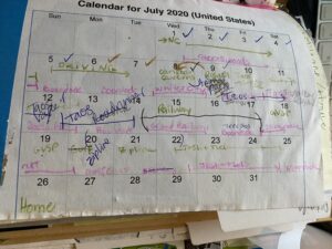
If there are specific days where we need to be somewhere, e.g. a wedding or a tour or a camp start date or a festival, then I need to visualize it within the trip because I need to work around those dates. I’m now playing with distance in relationship to those dates, so I break it down into legs. For example, if I’m on a cross-country trip but I need to be at a wedding in Omaha on a certain date, I’m not mapping MD > CA; I’m mapping MD > Omaha and Omaha > CA, within whatever my time constraints are.
- In general, I’m starting to break a trip down into legs.
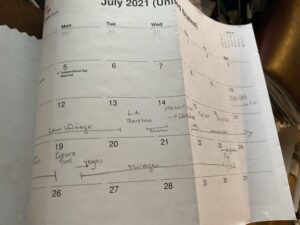
For the current trip, I had to work with the dropoff and pickup dates for my daughter’s summer program, which is how I began breaking the trip down into legs.

For some roadtrips, you might need/want to fly. It’s worth comparing the cost of plane tickets versus time, gas, hotels, and stress. If you do decide to fly, you then have the choice of driving a loop, i.e. starting and ending at the same airport, or starting at one airport and ending at another.
Flight Stopovers
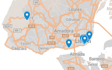
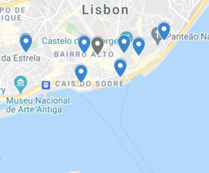
Some airlines have programs that allow you to stop at your connection within their country, spend a few days, and then fly on to your destination. We’re going to do that on this trip: we’re flying TAP Air Portugal, from DC to Barcelona via Lisbon. We’re stopping over for several days in Lisbon, staying in the city, and then flying into Barcelona a few days later. I was excited to have this option because now we can visit both Lisbon and Porto; plus, we can take Sequoia, who was going to miss the Portugal trip. Can you believe I talked my husband into this?!
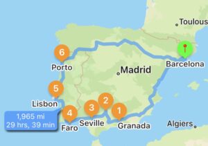
Anyway, here’s basically what I’m looking at:
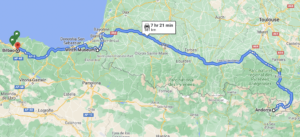
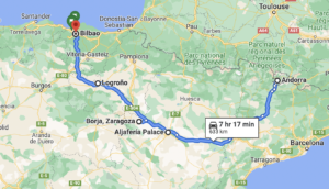
I can’t add all of my destinations for directions in Google Maps, even in Layers (*sigh*), so I’ve split it into two routes for you:
However, remember in inRoute, I can connect all the dots to create a full driving route:
Since I’ve shown you these stages mainly in Layers and since I love maps, here are a couple more views. You can choose to view as many or as few of your layers as you wish.
RESERVATIONS
I’ll save the reservation nitty-gritty for the Part III: Organization post, but I suggest that once you know your days in specific places, immediately check whether you need reservations for anything. Some of the major National Parks in the US now require reservations, and spots can go FAST. Check on your major tours, popular restaurants, museums, ferries (you don’t want to get stuck because there was no room on a ferry–especially if you’re driving an RV, which might have limited space), etc. When I’m looking into lodging, I immediately snatch up a place that looks amazing–especially if it’s going to be tourist season for that region. I don’t buy very many tickets ahead of time–just those things that I know from experience will fill up. For July, I already have our tour of Alhambra booked, but nothing else.
FINDING RANDOM OVERNIGHT PIT STOPS
I didn’t have to do this much for this trip, but it’s worth touching on how I identify random overnight pit stops.

When we RVed, the Allstays ONP Walmart app was super helpful for long-haul days.
But what if you’re on a regular-car trip? Sometimes you’re trying to get from Point A to Point B and it’s just too long a drive for one day, but you don’t know of anything interesting in between. I try not to waste a whole day without seeing something…
- If I’m looking for a pit stop when there’s a too-long stretch of driving, I pull up Google Maps and look at what’s between 1/2 and 2/3 of the way to the destination.
- Then, I do Google image searches of towns. If all I find in the first few results is a factory or a chamber of commerce with nothing interesting going on, I type in the next town. If something interesting pops up, I look into it so that even if we’re just parking our car and resting for the night, we have something beautiful to look at.
COMING SOON: The Organization
My next step is to create a planner of some sort. I’ll post about that in Part III. I enjoy creating the planner because it gets me excited about the trip, I can access it without internet connection (I’ve been in enough deserts, mountains, and foreign countries to know not to rely purely on the internet), and it serves as a travelogue/journal/scrapbook when the trip is over!
As I mentioned in my last post, I’ll be writing a Planning Series of posts, with maps, calendars, and slideshows of past road trips. Here are a few examples of route maps–leave me a note here or on social media if there’s a trip you’re dying to know more about, and I’ll bump it up on the list:
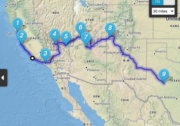
CA2TX2000 
#8inavan 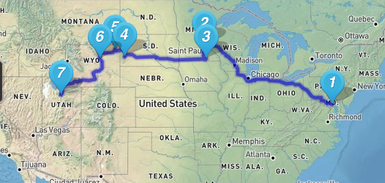
Maryland to Utah 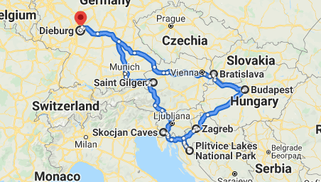
Central Europe 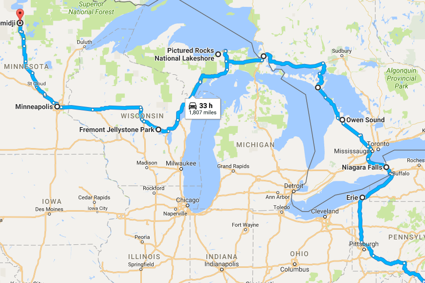
Mother-daughter portion of #GLRVRT17 Great Lakes RV trip 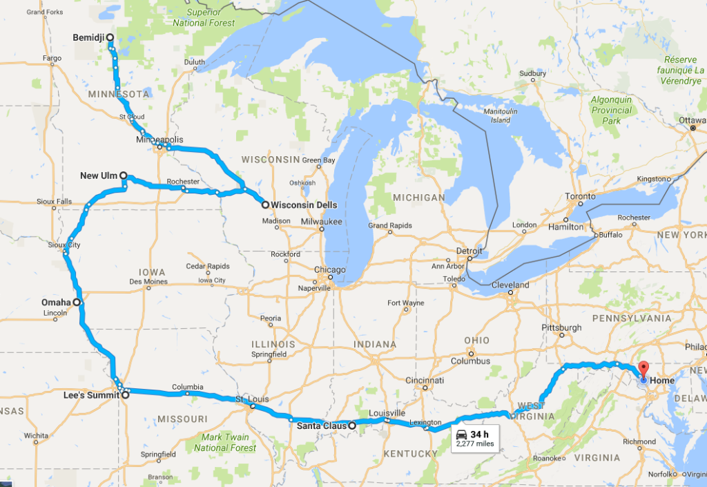
Family portion of GLRVRT17 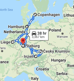
New Year’s road trip 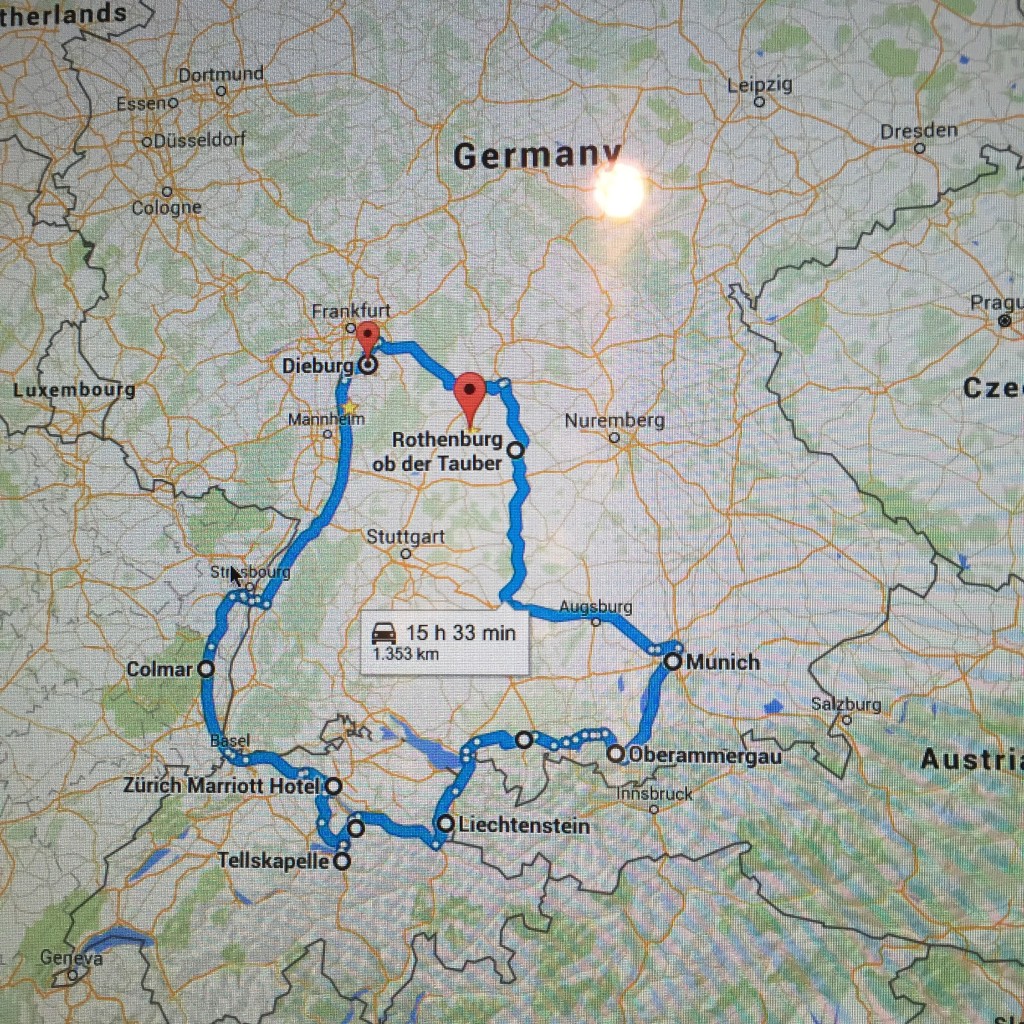
#finishSGH2016 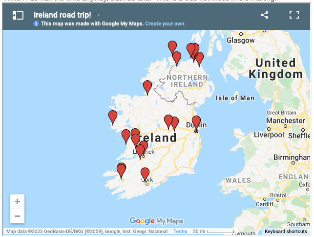
Ireland/Northern Ireland 
Westward Bound 2020 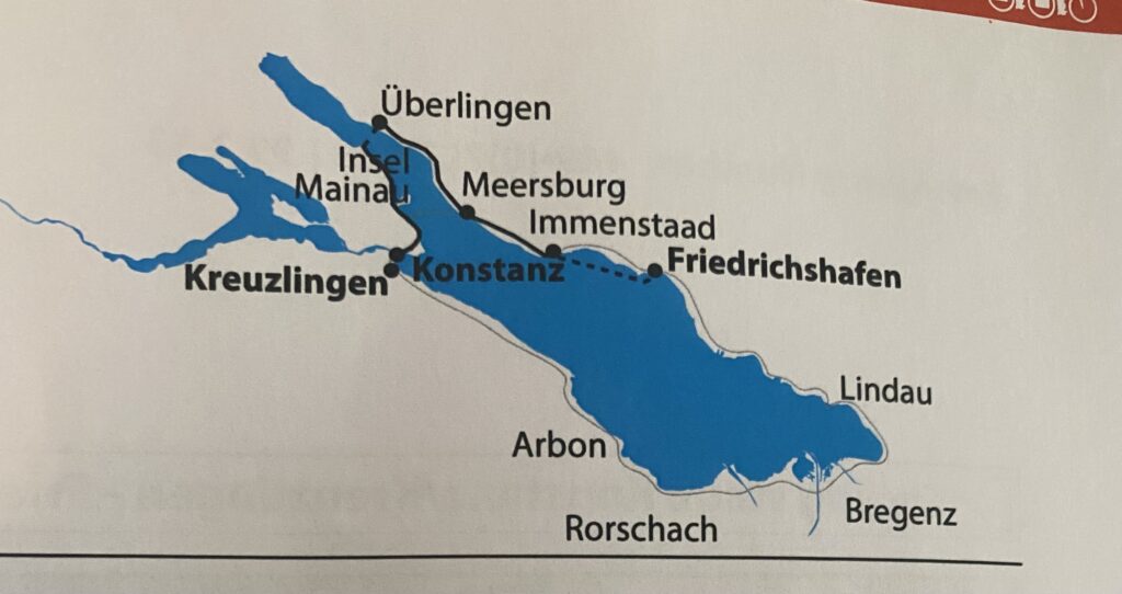
The Bodensee: took a road trip there, biked around the lake, finished our road trip loop 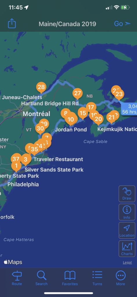
The Trip Not Taken (YET): cancelled New England/Canada RV trip 🙁 
Anyway, that’s (more than) enough for now…happy planning and stay tuned for Part III!
[…] so you’ve read Part I: The Research and Part II: the Route! and now you’re ready to dive into reading about the organization strategy that I personally […]